Clear Rules and Fair Compensation: Indio River
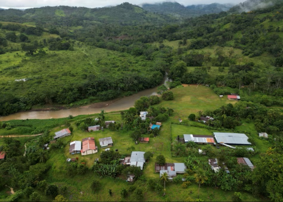
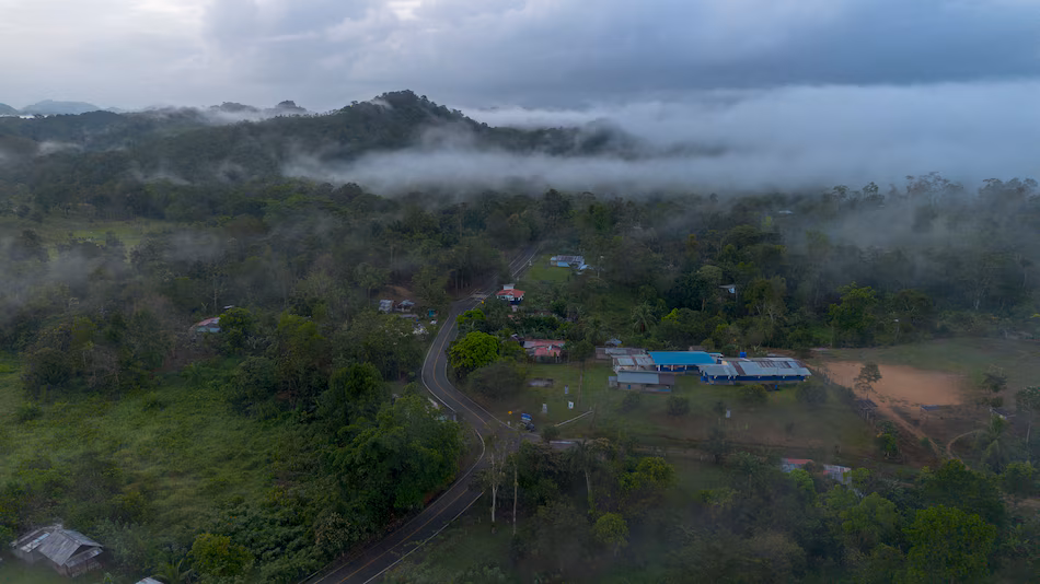
Aerial view of the small village of La Boca de Uracillo, a remote community of about 200 inhabitants along the Indio River in the province of Cocle, Panama.
The Río Indio Project is, above all, a national decision. It responds to a verifiable reality: guaranteeing water for more than two million Panamanians and the operational sustainability of the Canal in a context of climate variability and increasing consumption. Based on this, after a year of work and more than 200 collective and individual meetings with almost 70% of the families to be resettled, the Canal and the community have managed to design the rules that clearly define how each impact derived from the physical and economic resettlement will be compensated, which will serve as a basis to analyze each family case separately.
Panama Canal Aims to Put it Out to Tender in 2026 as They Advance Designs of the Reservoir on Indio River
Drone view of El Limón de Chagres, Colón province.
Panama Canal promotes the reservoir on the Indio River: design at 35%, geological studies underway and bidding planned for 2026-2027. The project to build the reservoir on the Indio River is progressing in its technical phase, with the goal of reaching 35% conceptual design completion, which will allow for its future tendering under the design-build modality. In parallel, the Canal Authority is evaluating sites to install the project’s camp, as well as planning access roads. “We are working on that to get the design to 35% completion,” Espino de Marotta pictured below explained.


When the Chagres River was dammed to create Gatun Lake (1908–1913) for the Panama Canal, over 2,000 people were displaced, and numerous villages and jungles were submerged, with old Gatun lying beneath 80 feet of water. This massive, artificial inland sea swallowed homes, churches, and parts of the 1850s railway, forcing a “New Town” construction and becoming a “forgotten casualty” of the engineering project.
- Submerged History: The creation of the 164-square-mile lake necessitated the flooding of several settlements, including the original village of Gatun.
- Forced Relocation: In 1908, the old Gatun village was abandoned, with residents moving to a “New Town” to escape the impending floods.
- The Transformation: What used to be hills and jungle became a network of islands, often marked by the tops of dead, submerged trees that remain as ghostly reminders.
- Modern Impact: The Lake remains critical to canal operations today, and the area around it serves as a massive wildlife preserve.

‘The Story of the Villages Beneath Lake Gatun is one of the Great Myths of the Canal Zone’: Marixa Lasso
Marixa Lasso is a historian specializing in Latin America and the Isthmus of Panama.
Her work focuses on how narratives of the past are constructed and on recovering stories that were left out of the official version. She is the author of ‘Erased: The Untold Story of the Panama Canal’, an award-winning book from the American Historical Association that examines the displacement of communities during the construction of the Canal. Her research reframes the Canal’s past not only as an engineering feat, but also as a process that transformed the population and territory of the isthmus.
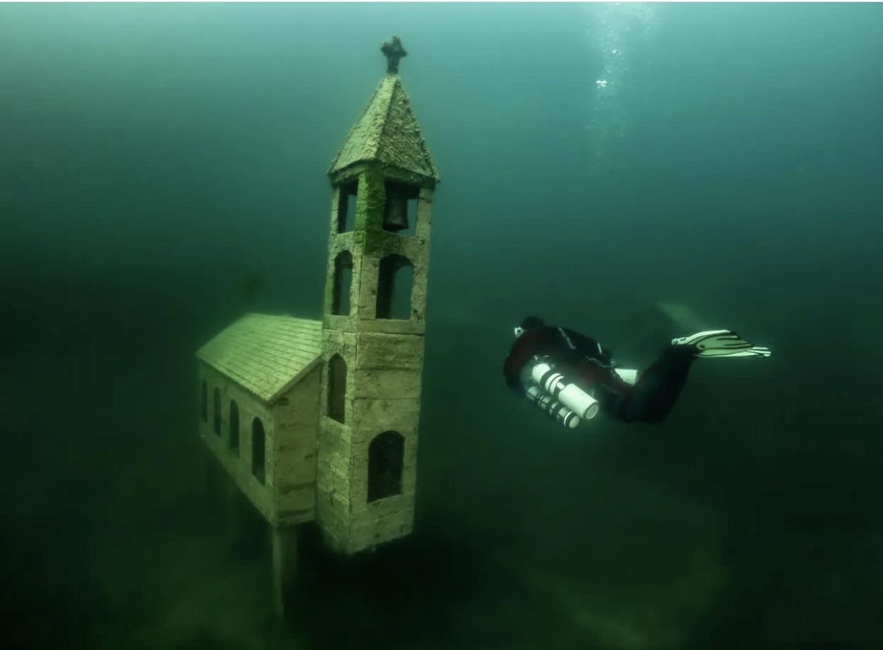
Marixa, if I go diving in Lake Gatun and go deep enough, will I find a flooded village?
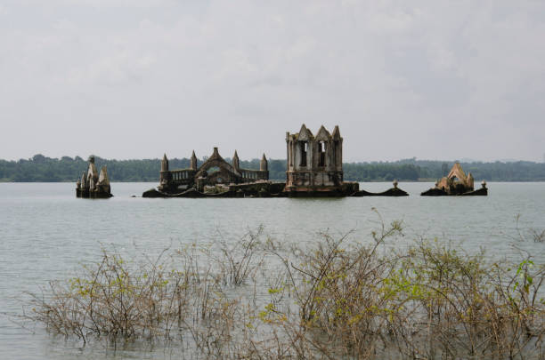
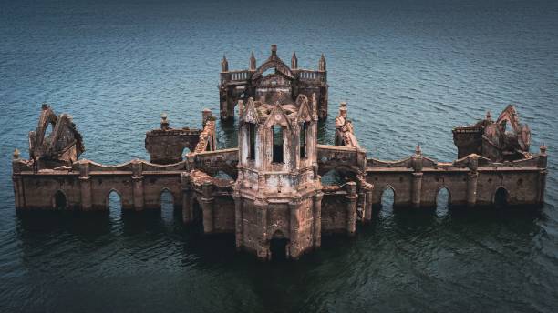
The idea that the villages were flooded beneath Gatun Lake is one of the great myths of the Canal Zone’s history. When I started this research, I swore that divers saw church towers when they went underwater. That’s not true. You can even go to the Cruces ruins, and they’re above water, near Gamboa.
In other words, the villages were indeed abandoned, but not flooded.
Exactly. The Canal Zone is much larger than Gatun Lake and was full of towns, farmland, people, and businesses that were never flooded. And yet, they were all wiped out.
Did the water scare them away?
They weren’t scared off by the water; it was a decision. In 1912, the United States government had an internal debate: what did we want in the Canal Zone? A populated or unpopulated area? Some, like Gorgas, said there were no health or security problems. Others, however—and they were the ones who won—said they didn’t want poor people, they didn’t want Black people, they didn’t want Panamanians, they didn’t want what they called undesirable people. There is an executive order from President Taft, from 1912, that mandates the depopulation of the Canal Zone.
In other words, it wasn’t a security problem.
It was neither a security nor a health issue, according to the channel’s top health official.
I suppose there were already people living there in the villages that were established there, long before.
Of course. Panama had been a transit zone since the 16th century. Numerous towns sprang up along the Cruces road, the Camino Real, and the Chagres River. These towns grew with the railroad and later with the French canal. By the time canal construction began, this was an urban area with very old municipalities. You have to imagine them, the larger ones—like Emperador, Nuevo Gatún, and Gorgona—as miniature versions of Panama City and Colón. With immigrants from all over, tenement houses, businesses, shops, even banks.
There were government structures established there.
Mayors, yes. At first, the United States supported them. But conflicts arose because the mayors took their position of defending the residents seriously and opposed some decisions of the Isthmian Canal Commission. So they were eliminated. The towns remained, but now they were called administrative districts, under the jurisdiction of the company.
That Gorgon you mention, does it have nothing to do with the Gorgon on the beach?
Yes, very much so. When the decision was made to depopulate, they sent the people of Gorgona to found a model town in Nueva Gorgona. But imagine: you’re in the middle of everything, full of merchants and farmers with that transisthmian market, and you send them so far away. That town doesn’t prosper.
It’s like uprooting a permaculture plant that grew on its own and putting it in another piece of land where it might not even be able to grow.
Exactly. What they describe is that all the merchants had full shops and no one to sell to.
So, do they fall under the company’s jurisdiction?
Yes. And they did the same with all the towns: an order is an order. Everyone has to leave; they eliminate the existing towns and then create new ones that will become the towns of the canal company.
Was there any resistance? Did people want to stay?
People didn’t want to leave, that much is clear. There are documents from farmers who returned to their crops and didn’t want to abandon them. But I didn’t find any strong resistance. There are complaints and comments from government officials asking how long they were going to keep using the Canal as an excuse to demand land. Those involved at the time knew that most of the people evicted weren’t on land needed for the canal.
So, clearly these lands weren’t going to flood. Where did this myth come from?
The first to formalize the myth was Gil Blas Tejeira with his book The Lost Villages .
My uncle!
Your uncle. But it’s not his fault, because he’s perpetuating a myth that already exists. I think the depopulation was as rapid as a flood and was linked to the lake because it did happen at the same time. Furthermore, in the chronicles of the Isthmian Canal Commission, what was published stopped mentioning the depopulation order and started talking only about the flood. Myths aren’t invented; something complex is simplified into a grand narrative.
There was something you told me before we started the interview that resonated with me: that myth is like a way of processing that traumatic event.
A very traumatic event. By the 1912 census, there were 62,000 people there, when all of Chiriquí had 57,000. Suddenly, in one or two years, everyone had to leave: the merchants with their businesses, the people dismantling their houses, abandoning their crops.
And do displaced people have memories? Do they still remember things from that time?
Memories remain from people who heard the stories from their grandparents. I went to interview people in Nuevo Chagres, and they remembered stories of what had happened. But it remains local, familial, not part of the national memory. In the national memory, it’s condensed as that flood.
Why is it important not to go with the flood narrative?
For two reasons. First, it obscures the complexity of the urban infrastructure. The thousands of workers who came to build the canal weren’t housed in homes provided by the Isthmian Canal Commission; most lived in houses built by Panamanian capitalists. The myth erases our participation in the canal’s construction. Second, it makes us think it was inevitable, that we had to choose between the towns and the canal. When that wasn’t the case. A technical decision was used to mask what were political and social decisions.
The flood as a justification for things they perhaps didn’t want to say openly.
Exactly.
What would have happened if the United States had made the opposite decision?
That possibility was very real. If those in favor of maintaining the populated area had won the debate, Gorgona would have remained where Gamboa is today. What is now Balboa would have continued to be La Boca, the Panamanian town at the mouth of the canal. And we would have had a very different Panama City, more integrated into the transisthmian zone, as it had historically been. And imagine if those centuries-old towns like Gorgona and Chagres were still there.
Well, I went in imagining a church underwater, and now I’m leaving imagining entire cities where they used to be. Thank you, Marixa.
It was a pleasure talking to you.