The Passage of Two Tropical Waves in the Next While Will Activate a New Tropical Wave Watch
The areas expected to experience high intensity include Chiriquí, Veraguas, Coclé, Western Panama, Panama, Darién, the Emberá region, the Guna Yala region, Colón, Bocas del Toro, the Ngäbe Buglé region, and maritime areas.
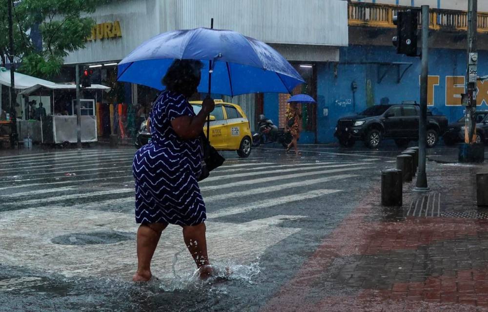
The Institute of Meteorology and Hydrology of Panama (IMHPA) will activate a new watch alert on Thursday, August 21, and will maintain it until Saturday, August 23, due to a period of rainy events that will be accompanied by electrical activity and possible wind gusts in much of the national territory. These weather conditions will be caused by the passage of tropical waves 24 and 25 in the Caribbean Sea and Central America basin, along with the interaction with other atmospheric systems in the region.
During this period, daily rainfall accumulations of 30 to 160 millimeters will be recorded; these amounts are considered very heavy, according to the Impha measurement table. Given this instability, the Imhpa warned that rivers could rise, landslides, tree falls, and possible flooding could occur in vulnerable areas. The areas expected to experience the greatest intensity of the event are: Chiriquí, Veraguas, Coclé, Western Panama, Panama, Darién, the Emberá region, the Guna Yala region, Colón, Bocas del Toro, the Ngäbe Buglé region, and maritime areas.
The public is reminded to follow the recommendations of the National Civil Protection System (Sinaproc) to avoid regrettable situations:
- Do not cross flooded rivers or streams.
- Avoid touching or stepping on electrical cables.
- Move away from houses, trees, or poles that are in danger of falling.
- Take extreme precautionary measures against possible roof collapses or falling trees.
- Take shelter under secure structures, away from poles and windows.
- Avoid driving through flooded streets and drive with caution.
- Stay away from areas prone to landslides.
- Heed official announcements and avoid risking your life by crossing streams.