What is Tropical Wave #24 Causing in Panama?
Panama: The Institute of Meteorology and Hydrology of Panama (IMHPA) issued a new meteorological bulletin reporting that Tropical Wave 24 has entered national territory, generating unstable conditions across much of the country. This atmospheric phenomenon is causing heavy rains, thunderstorms, and gusty winds, especially in the Caribbean and Pacific regions. According to the Meteorological Institute’s forecast, widespread rain and downpours, accompanied by lightning and possible gusts of wind, were reported during the early morning hours of Thursday, August 21:
- Caribbean Region: Bocas del Toro, Colón and the Guna Yala Region.
- Pacific slope: Darien, Emberá region, Panama, Western Panama, Cocle, Herrera, Los Santos, southern Veraguas and the Chiriqui Lowlands.
In mountainous areas such as central Veraguas and the Chiriquí Highlands, the sky will remain cloudy throughout the day. In the afternoon, rainfall will intensify in Chiriquí, Veraguas, the Azuero Peninsula, Bocas del Toro, the Ngäbe Buglé region and part of Colón, while cloudy skies with isolated light to moderate rains are expected in the rest of the country.
Related note: A new tropical wave watch will be activated due to the passage of two tropical waves in the next few hours.
⚠️ Warning: Microbursts of wind are not ruled out during thunderstorms, local phenomena that can cause damage from sudden, intense winds.
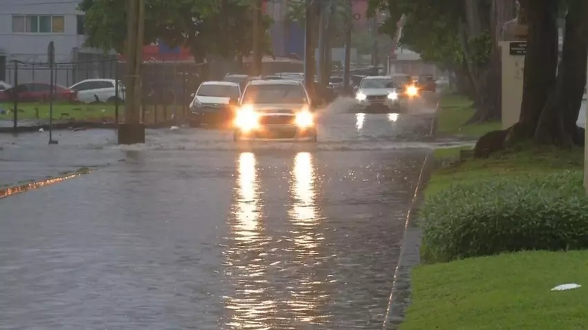
Impha forecasts that accumulated rainfall during the day will range between 20 and 100 millimeters (liters per square meter), with a higher concentration in mountainous areas and regions near the Caribbean. Special caution is recommended in areas prone to flooding, landslides, and waterlogging on roads.
Temperatures and winds: humidity and northwesterly winds
Minimum temperatures will be between 21°C and 25°C, while in the Central Mountain Range they could drop to 14°C. Maximum temperatures will not exceed 29°C in most of the country, with values between 22°C and 28°C in higher areas.
The prevailing winds will be from the northwest and west, with sustained speeds between 5 and 15 km/h, in confluence with flows from the south and southwest, which favors atmospheric instability.
Sea conditions: Caution on coasts due to waves
Regular sea conditions are expected on both coasts of the country, but caution is required during storms, when the sea can become choppy.
- Caribbean: Waves up to 1.5 meters, with periods of 5 to 8 seconds.
- Pacific: Similar height (up to 1.5 m), but with longer periods, between 8 and 11 seconds.
Fishermen, sailors, and tourists are advised to take extreme caution when engaging in maritime activities.
UV radiation: Risk Level from Low to High
Despite the cloudiness, the UV-B radiation index will reach low to high levels (indexes between 2 and 7), with exposure time for skin burns ranging from 30 to more than 60 minutes. It is advisable to use sunscreen and wear hats, and avoid prolonged sun exposure during the middle of the day.
Recommendations
The institute urges the population to:
- Stay informed through official channels.
- Avoid areas with rivers, ravines and unstable slopes.
- Take precautions against possible power outages due to thunderstorms.
- Follow the instructions of security and civil protection authorities.