Forest Fires: How Satellite Imagery is Fueling Early Detection and Recovery
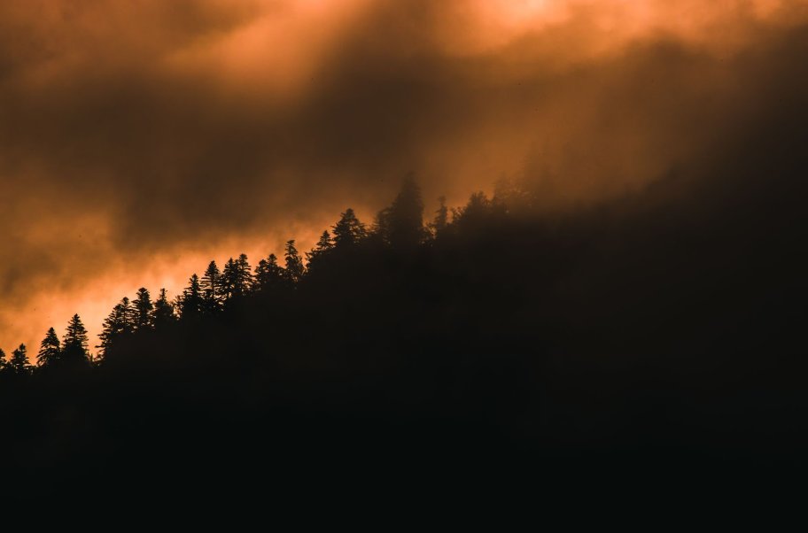
Wildfires are no longer rare, seasonal events. They have become persistent threats, increasing in both frequency and intensity around the world. Climate change, extended droughts, and unpredictable weather are all contributing to more destructive fire seasons. As these blazes grow harder to predict and control, the need for smarter, faster monitoring tools becomes more urgent. In response to this challenge, satellite imagery is stepping into a critical role, offering new ways to spot fires early and support recovery efforts in their aftermath.
One of the most impactful advances in this area comes from the Sentinel satellites, part of the European Union’s Copernicus program. These satellites provide free, high-resolution data that allow scientists, emergency responders, and forest managers to monitor fire-prone regions in near real-time. With their frequent updates and wide coverage, Sentinel images are helping to detect fires sooner, track their movement, and assess damage more accurately than ever before.
Forest Fire Hotspots Across the Globe
From the vast boreal forests of Canada to the tropical landscapes of the Amazon and the dry bushlands of Australia, certain regions have become global wildfire hotspots. These areas are not only seeing more frequent fires but are also experiencing longer burn periods and larger areas affected. Southern Europe, particularly countries like Greece, Spain, and Portugal, has faced record-breaking fire seasons in recent years. At the same time, parts of California and the Pacific Northwest in the United States continue to battle intense fire activity year after year. Providing wildfire relief donations plays a critical role in supporting these devastated communities by funding emergency supplies, rebuilding infrastructure, and restoring the natural habitats lost to these catastrophic blazes.
What makes these regions especially vulnerable varies. In remote northern latitudes, lightning strikes often ignite blazes that smolder for weeks. In South America, agricultural practices like slash-and-burn clearing contribute to widespread forest loss. Mediterranean countries face increasing risk from prolonged droughts and intense heatwaves. Regardless of the cause, the challenge is the same: detecting fires early and understanding how they spread. Satellites play a crucial role in meeting this challenge. With the ability to scan vast territories on a regular basis, they help track fire activity in areas that are difficult or dangerous to reach on the ground. Satellite imagery provides more than just location data. It offers insights into critical information for emergency response and long-term recovery planning: how fires behave, how fast they move, and which ecosystems are most at risk.
Sentinel-2 Data and Its Role in Fire Damage Assessment
After a wildfire has been detected and contained, the work is far from over. Assessing the full extent of the damage is essential for recovery planning, environmental restoration, and understanding long-term ecological impacts. This is where Sentinel-2 imagery becomes especially valuable. It allows scientists and land managers to map burn areas with precision, identify zones of total vegetation loss, and monitor the slow process of regrowth over time.
By comparing Sentinel satellite imagery captured before and after a fire event, analysts can detect subtle changes in vegetation health, soil exposure, and moisture levels. This comparison helps determine how severely an ecosystem was affected and which areas may require urgent rehabilitation. These insights are also used to support insurance claims, guide reforestation projects, and inform policies on land use and fire prevention. The wide availability and regular updates of Sentinel data mean that fire damage can be tracked over weeks and months, making it one of the most effective tools for long-term environmental monitoring.
Long-Term Forest Degradation
While the immediate aftermath of a wildfire often draws the most attention, the long-term effects can be even more damaging. Fires not only destroy trees and vegetation but also disrupt entire ecosystems. Soil structure can break down, water cycles are altered, and habitats for countless species are lost. In some areas, repeated burns prevent forests from fully recovering, leading to permanent changes in the landscape.
Satellite data, including Sentinel-2 images, plays a critical role in uncovering these slower, less visible transformations. By continuously monitoring the same regions over months and years, satellites can reveal trends in vegetation decline, shifts in species composition, and changes in land cover. These long-term observations help scientists understand how forests respond to fire over time and whether they are rebounding or degrading. This information is vital for shaping conservation strategies and ensuring that recovery efforts are grounded in evidence rather than assumptions.
Tools That Make Sentinel Weekly Satellite Imagery Accessible for Everyone
Accessing satellite data used to be a task limited to scientists and specialized agencies, but today, a growing number of platforms are making it easier for anyone to explore and analyze it. Among them, EOSDA LandViewer offers a user-friendly interface where both professionals and the general public can view and interpret satellite imagery related to wildfires. These platforms are helping to democratize access to crucial environmental information.
With just a few clicks, users can monitor burn scars, track fire progression, and assess changes in vegetation using reliable satellite data, including Sentinel-2 satellite images. The ability to view data in near real-time or look back over months of past activity gives users a powerful window into the dynamics of wildfire events. Whether you’re a land manager planning recovery efforts or a citizen concerned about fires near your home, EOSDA LandViewer makes it possible to gain valuable insights without needing a background in remote sensing.
Future of Fighting Fires with Technology from Space
Looking ahead, the role of accessible satellite tools in wildfire management is only expected to grow. As technology continues to advance, these platforms will offer faster updates, clearer imagery, and more powerful analytics to support early detection and better response. The ability to monitor fires in near real time and assess long term damage will be essential for both immediate action and future planning. By making satellite data available to more people, including researchers, emergency teams, and local communities, we can improve how we respond to wildfires and how forests recover in the years to come.